Endalsstugan
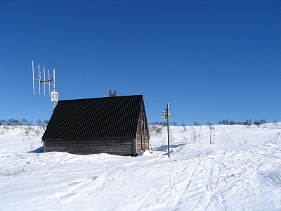
Shelter
| Region: | Jämtland |
| Location: | Sylarna |
| On trail: | Blåhammaren–Storerikvollen |
| Coordinates: | 63°08'37"N, 12°06'47"E |
| Altitude: | 790 m |
| Fjeld map: | Z6 |
| Accommodation: | Two cots in an emergency |
| Service: | Privy, assistance phone |
A shelter erected by residents of the Norwegian town Trondheim in 1930, in gratitude of the Swedish fjeld rescue service's saving a group of Norwegian tourists in the area some years prior. There is also a storm bell from that time beside the shelter.
| Approximate distances | |
|---|---|
| Storerikvollen | 8 km |
| Blåhammaren | 8 km |
| Fiskåhøgda | 14 km |
| References | |
|---|---|
| Around Sylarna 2006 | Day 8 |