Pieggaluoppal
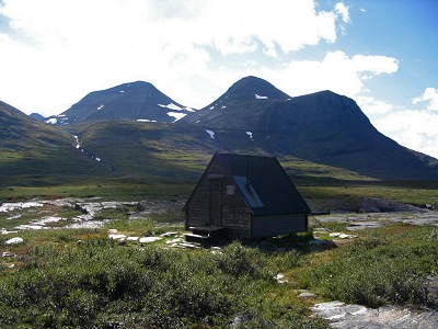
Shelter
| Region: | Northern Lapland |
| Location: | Abisko |
| On trail: | Kaisepakte–Rovvidievvá |
| Coordinates: | 68°11'02"N, 18°40'04"E |
| Altitude: | 760 m |
| Fjeld map: | BD6 |
| Accommodation: | – |
| Service: | Privy |
This used to be a standard shelter off the trail, situated at the outflow of the rapids between Áhpparjávri and Bieggaluoppal, but unfortunately it was destroyed in a fire in the winter of 2010.
| Approximate distances | |
|---|---|
| Abiskojaure | 14.5 km |
| Alesjaure | 19 km |
| Unna Allakas | 26.5 km |
| Kaisepakte | 32.5 km |
| Vistas | 33 km |
| Årosjåkk | 53 km |
| Rádunjárga | 11.5 km |
| Rautasjaure | 15 km |
| Mårma | 19 km |
| References | |
|---|---|
| Northern Kungsleden 2005 | Day 2 |
| Mårma 2008 | Day 5 |