Stabre
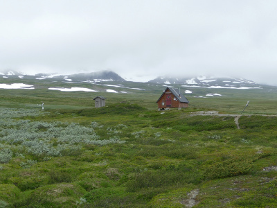
Shelter
| Region: | Vindelfjällen |
| Location: | Syter |
| On trail: | Tärnaleden |
| Coordinates: | 65°49'08"N, 15°21'09"E |
| Altitude: | 800 m |
| Fjeld map: | AC2 |
| Accommodation: | Two cots in an emergency |
| Service: | Privy, emergency pack |
A shelter on the Staabre highland between the southern part of Norra Storfjället and Tärnaån.
| Approximate distances | |
|---|---|
| Solberg | 9 km |
| Syter | 10 km |
| Viterskalet | 13.5 km |
| Laisaliden | 18 km |
| Syterskalet | 7.5 km |
| Vallentjåkke | 8.5 km |
| References | |
|---|---|
| Vindelfjällen 2019 | Day 1 |
| Naturkartan website | |