Saturday 23/8
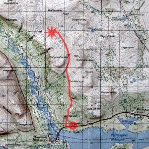
Vistasdalens naturrastplats – Dolakčohkka
| Horizontal distance: | 13 km |
| Vertical distance: | +220 m, -40 m, +440 m, -80 m, +40 m, -60 m |
| Time: | 4 h |
| Lunch break: | (none) |
| Dinner: | Game casserole |
| Night accommodation: | Tent |
| Stage classification: | Easy |
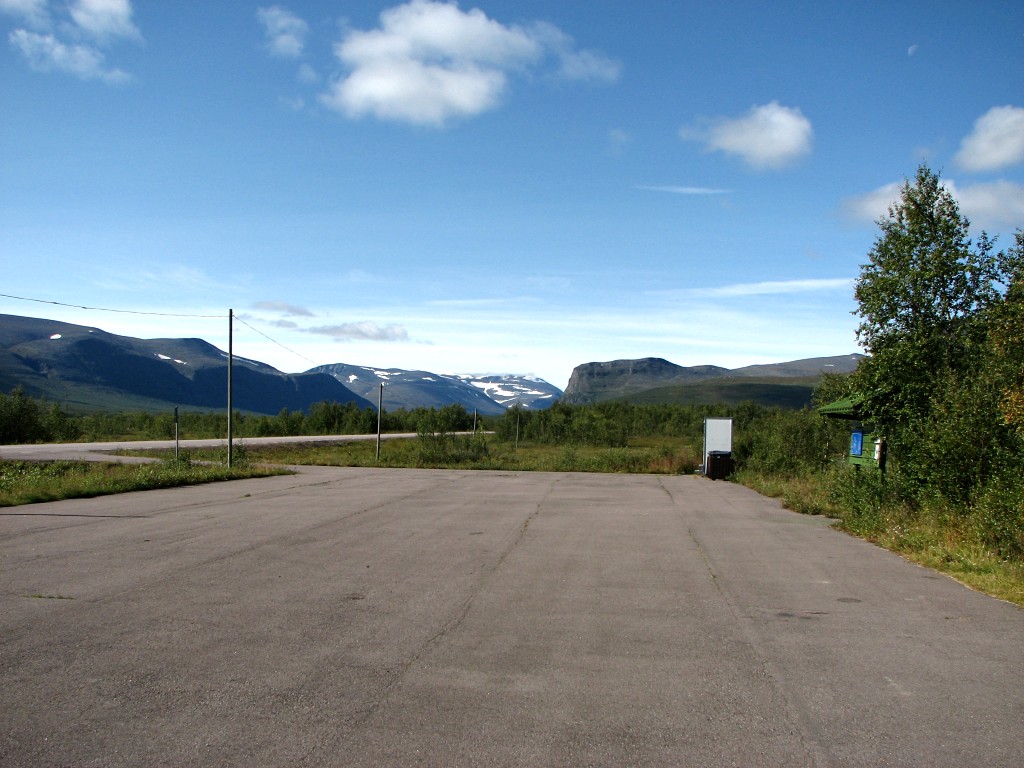
At the lay-by
To great lack of surprise to all, the train pulled in at Kiruna central well after the appointed time, and there were quite a few people wanting to get onto the bus to Nikkaluokta, so there were actually two buses this day. The weather was very nice there, turned cloudier during the first part of the journey, and then cleared again closer to the destination. The high peaks ahead of us were, however, still occluded by persistent clouds which were only slowly shrinking. I asked the bus driver to let me off a few kilometers before Nikkaluokta itself, so as to spare me from walking back those same kilometers since I was not going westwards like "everyone else".
My improvized station was a lay-by called Vistasdalens naturrastplats, which consists of a long parking strip and a number of lean-tos and small cabins scattered in the near forest, all connected by a short walking track. This track I tried out, looking over the facilities, and then seated myself on a table to consume the lunch I had brought before setting off; it was rather warm, but a pleasant wind was balancing the scales. I dumped the garbage thereby produced in a garbage container (this was why I had chosen the lay-by in the first place – it made no sense having to carry a lot of spacious trash right from the start) and then walked along the side of the road to the start of the Vistas trail.
It was my intention to walk upon this trail for a bit, turning up the slope somewhere after Alip Gáhttár and make my own way from there. However, right at the start I observed the tracks of a four-wheeled ATV going off to the right, and reflecting upon the significance of this it came to me that they were in all likelihood going to the reindeer-watching hut that lay on (or near) my route, so I thought that I could just as well try them out – at least for a bit, to see where they led. After a while a regular path appeared that went on through the drier parts of the forest when the ATV tracks took to boggy terrain, and I followed that instead, winding to and fro. This path was obviously a travelled one, but there were marks which at first I could not place, but after nearly stepping in a substantial heap of horse dung realization struck.
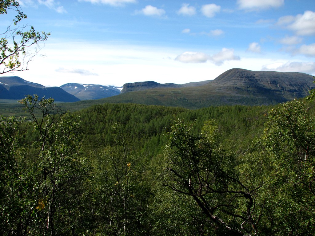
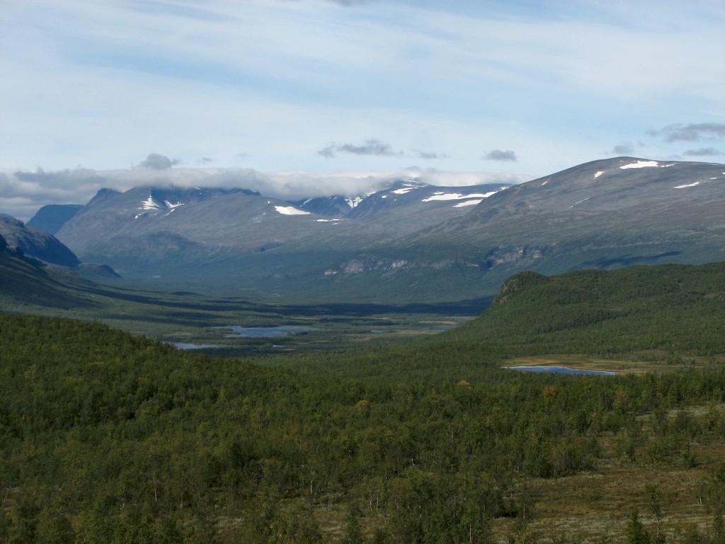
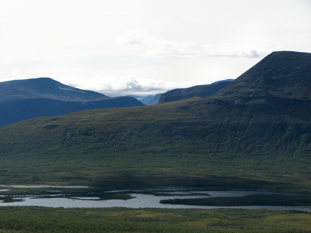
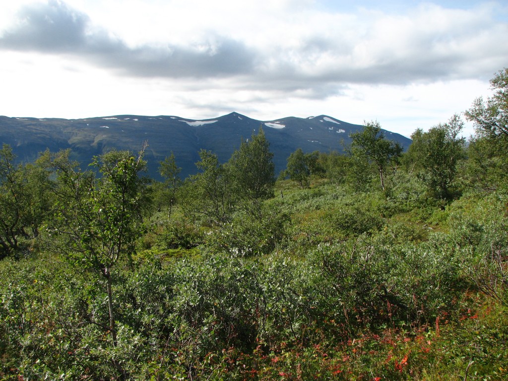
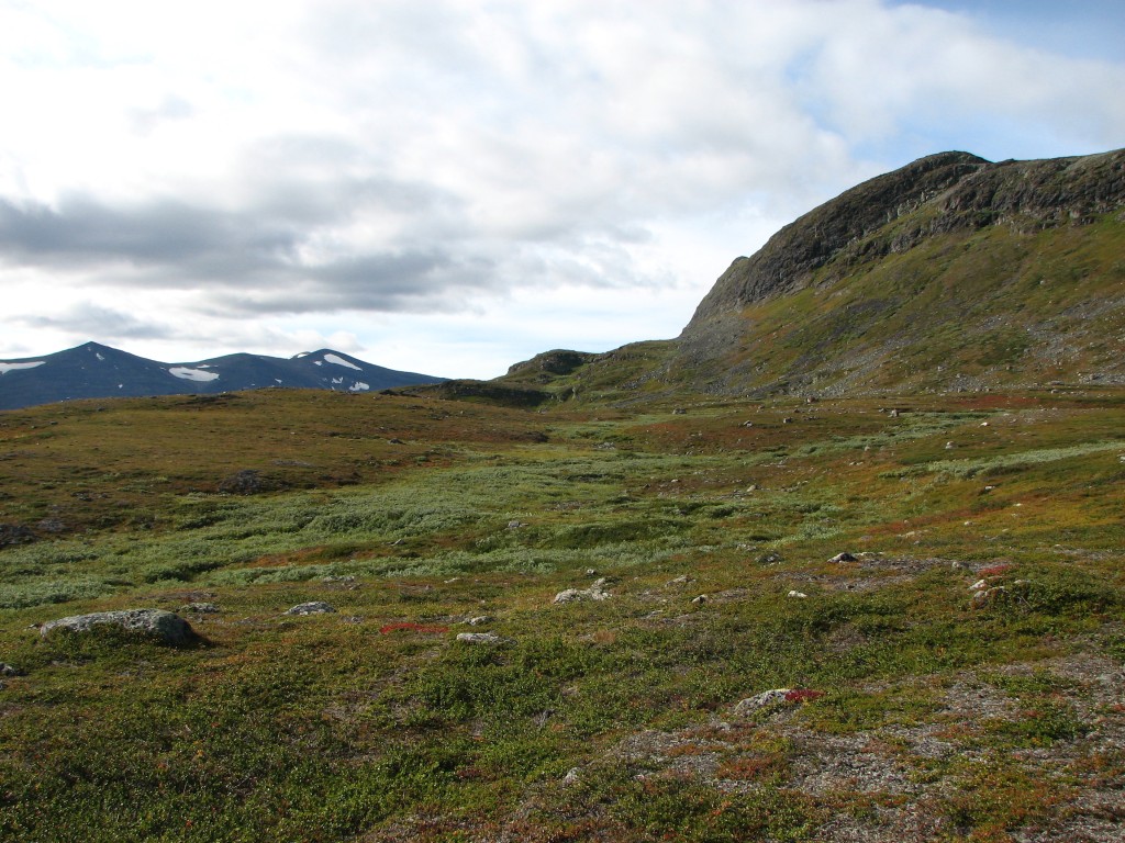
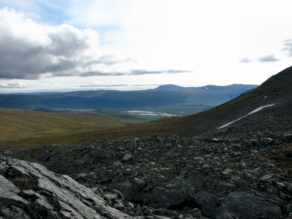
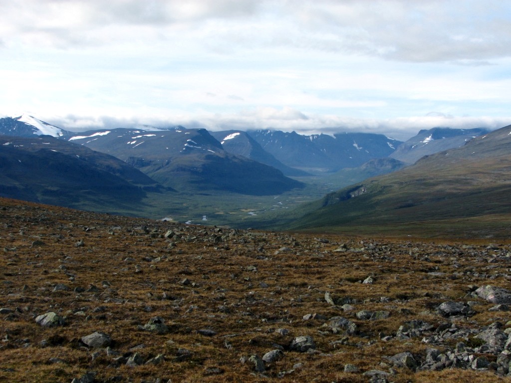
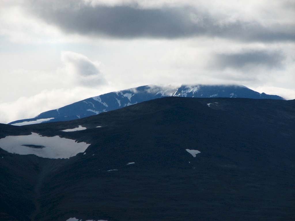
After a good many turns I came upon the original tracks once more just as they started climbing the slope. It was still very warm – especially going up the fairly steep incline – but at least the trees provided some shade. A little bit past the crest the vegetation opened up, and the view up Visttasvággi was fantastic – when walking down at the bottom it takes up to two days before similar sights can be seen, and now a very large part of the lush, beautiful valley lay sprawled out below me in under an hour.
Further off to the northwest the peak-clutching clouds were still performing their task, and out of the shelter of the trees the wind was appreciable. I stayed on the tracks, going up onto a bare crest, through more forest, and then onto another treeless rise just before some small meres. There the ground was dry and gravel-like, which made me lose the tracks, so I chose the most natural route, which was west of the topmost mere in order to avoid the seemingly marshy part between them. And, what do you know, there I found the tracks again, but it did not take long before I lost them in the subsequent forest. At first it was easy navigating through the underbrush, but as I progressed the vegetation grew denser and more difficult, which prompted some detours. Having passed the troublesome region, however, I suddenly found myself on the tracks once more, and soon I was out on open land again – and now I could see the hut some distance ahead. A high veil was growing on the western sky, and behind it more clouds were gathering, but in my direction of travel everything was just dandy still.
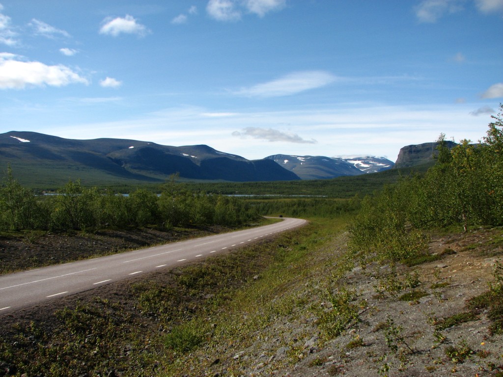
Leaving the road
Govggenjunni
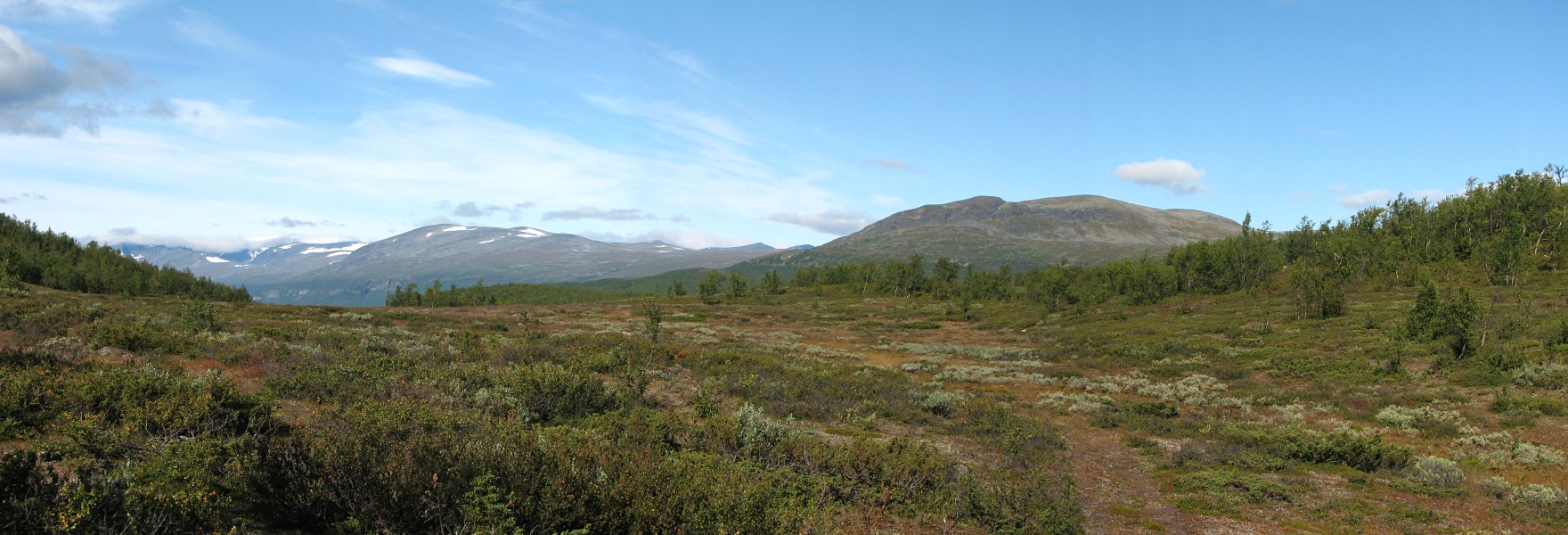
Panorama northwestwards from Alip Gáhttár
Vássačorru in the distance
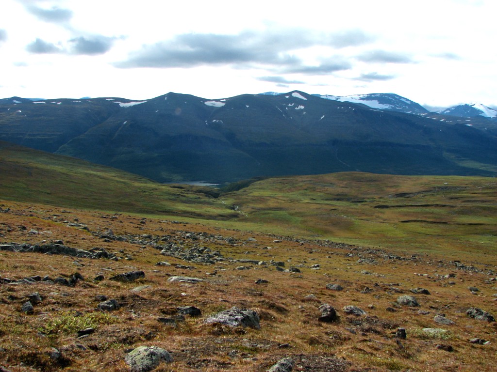
Beautiful Visttasvággi
Govggečorru
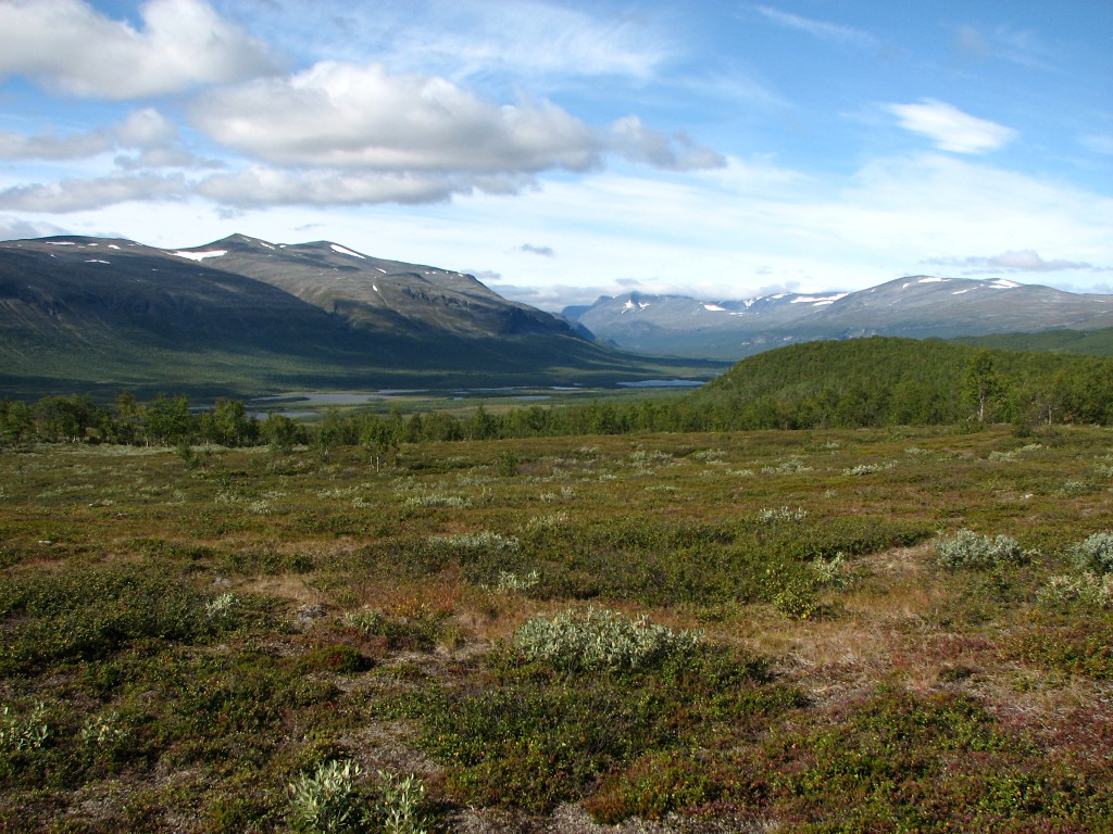
More of Visttasvággi
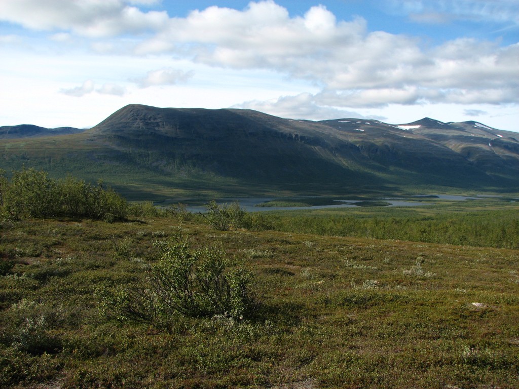
Guhppusčohkka ahead
(notice tracks)

Passing some meres
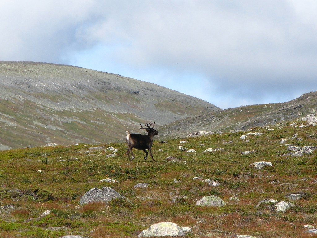
Natural inhabitant
Spotting the reindeer-watching hut
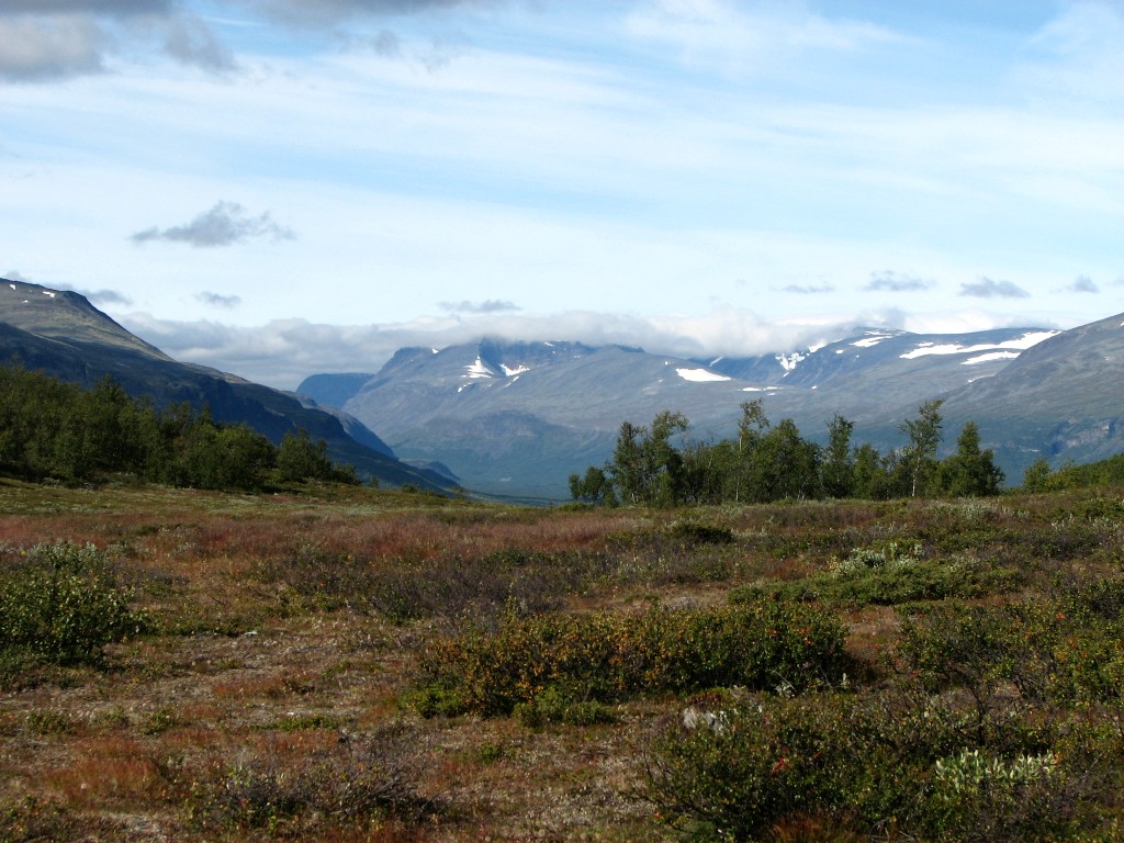
The delta of Visttasjohka below Govggenjunni
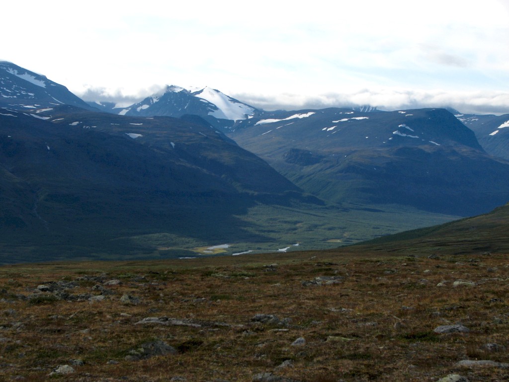
One more look up Visttasvággi before...
...reaching the hut
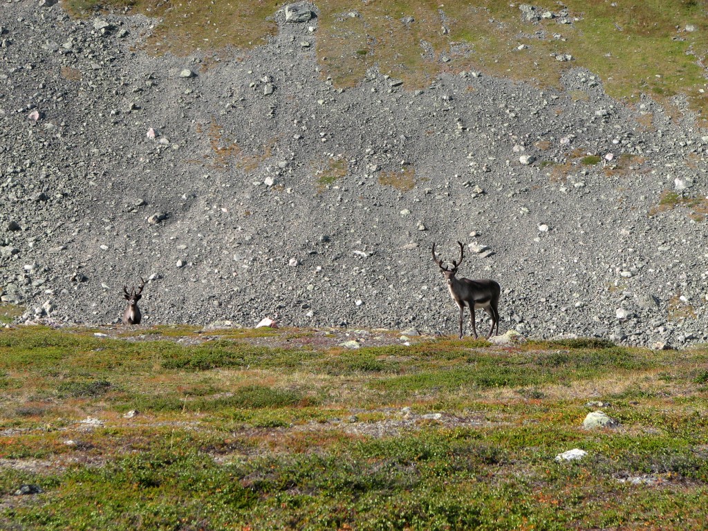
I passed by the building, which was all locked down, crossed the nearby stream with a few simple steps, and a wet portion with a larger number of not quite as simple steps. I was now at a sizeable patch of osier, and I elected to go around it rather than taking the brute-force approach. A few scattered reindeer observed as I closed in on the Guhppusgorsa ravine, which with some effort I crossed where I got to it; it was not too deep, but the sides were steep enough, and especially the ascent on the other side took its toll. This was an entirely unnecessary exercise, of course, as the whole thing flattened out considerably a bit further up anyway.
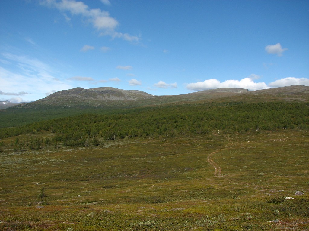
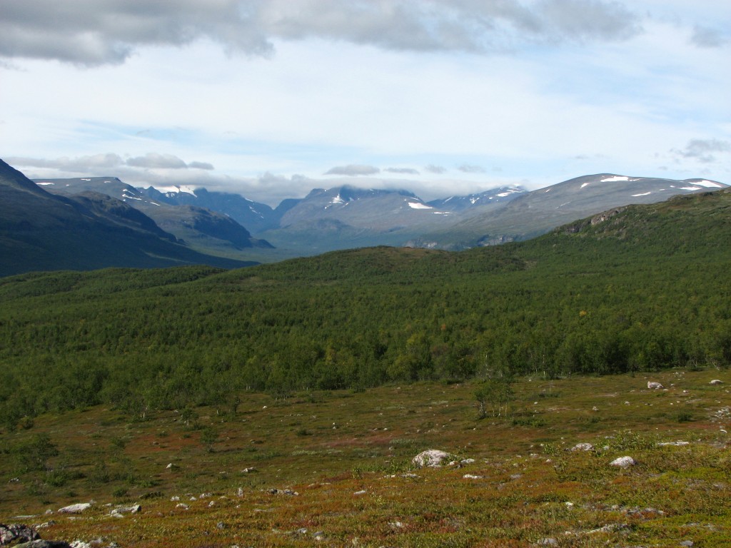
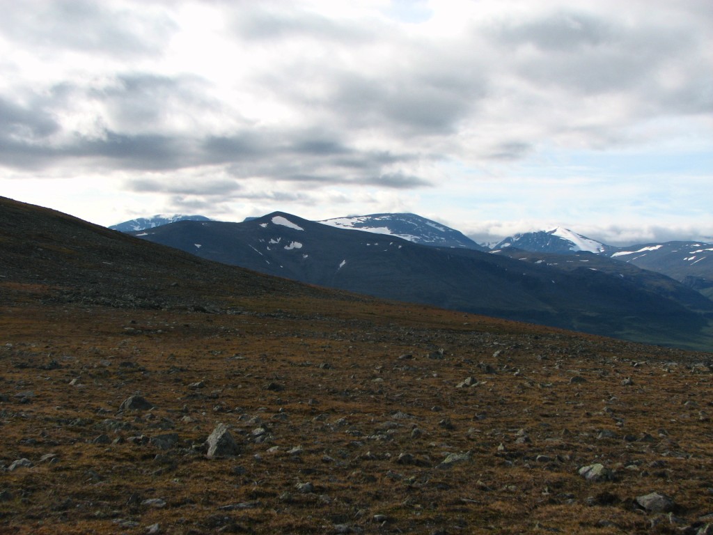
The heathy terrain on the other side was, however, most to my liking, and I made good speed up towards the little pass; the incline was hardly noticeable, and the reindeer remained all around. As the sun was slightly weakened by the western veil the heath gave way to more stones, which in turn gave way to grass, and it was only the last bit up to the actual saddle that consisted of rocks – and even then there was moss and stuff in between. Just there a bank of clouds come out of the northwest covered up the sun, but the effect was quite local, and the views of my continued route were alluring indeed.
Heath
Points upon Govggečorru
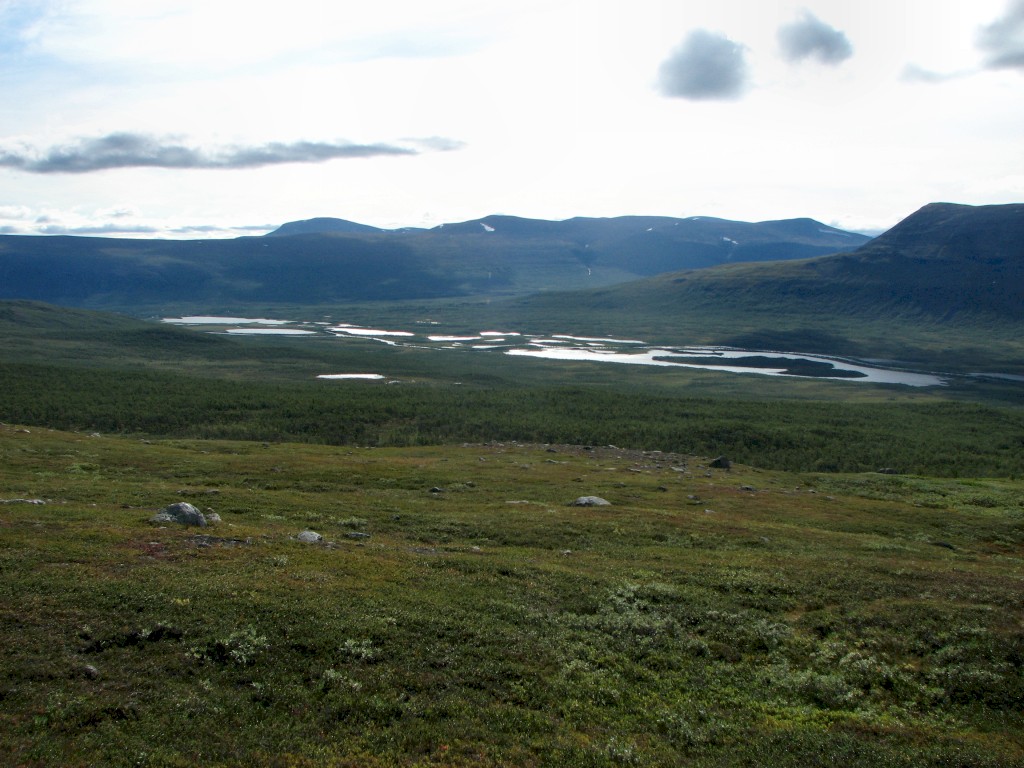
Looking back at the delta
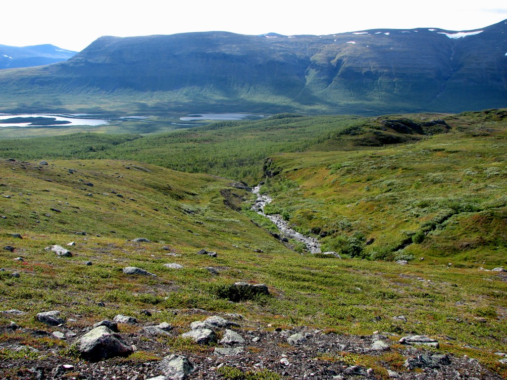
Guhppusgorsa down
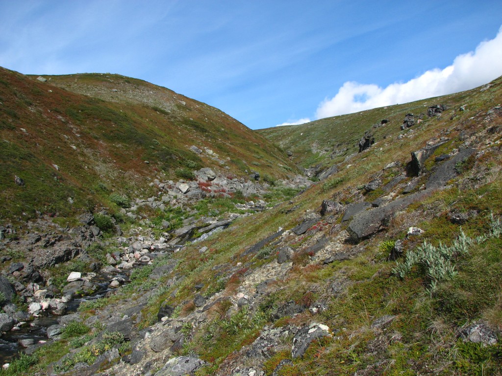
Guhppusgorsa up
Passing close by Guhppusčohkka...
...under the gaze...
...of the local residents
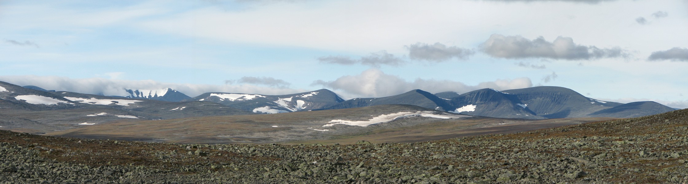
Panorama over Vierročohkka and Rássebávttáščohkka from the saddle
Last look back
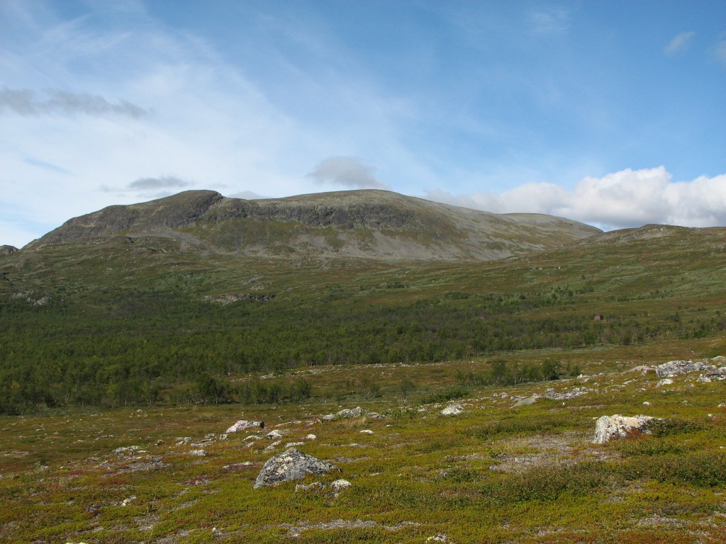
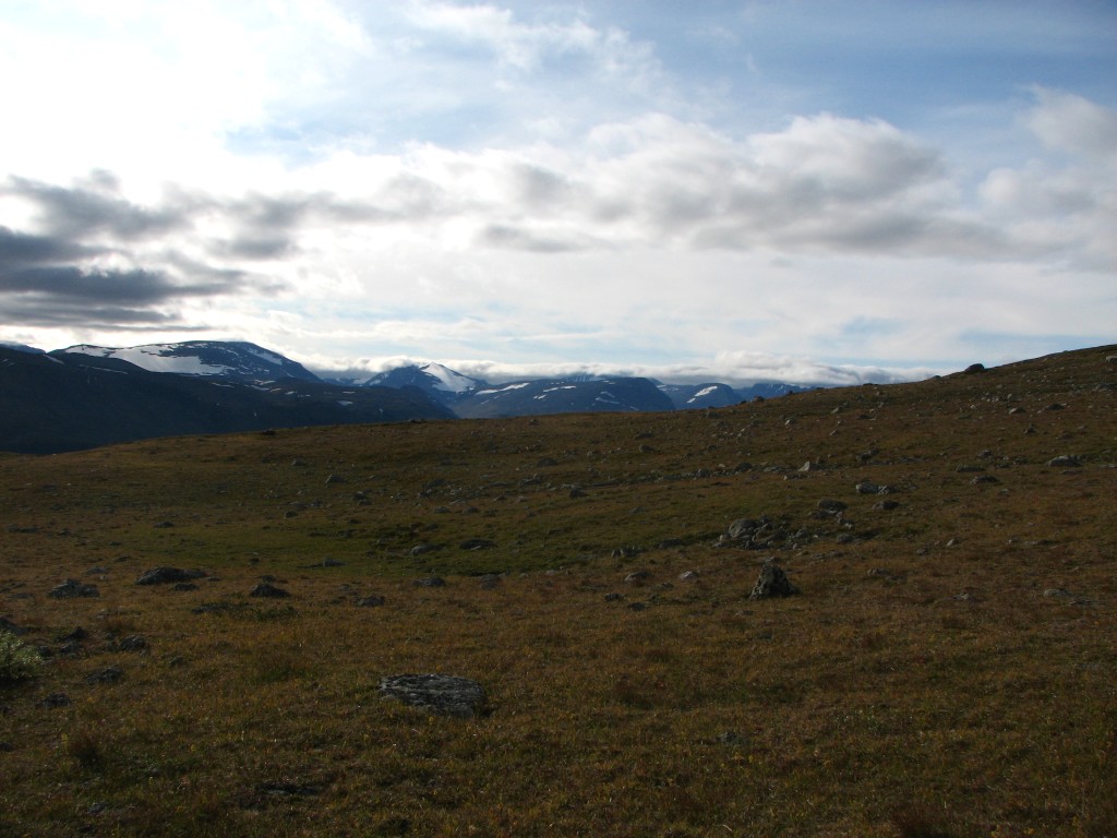
From the saddle I maintained my altitude at first, going over rather stony ground in shifting conditions concerning both sun and wind. The nearby little dell of the stream that flows through Gaippugorsa seemed very nice for camping, with large grassy areas and such, but by virtue of being a dell it offered little in the way of views except over Govggečorru, which felt to me somewhat limited given what I still had before my eyes. I therefore proceeded up on the other side, passing a little hill after which a number of great spots immediately appeared, but they were only great as such – the proximity to water is paramount, and there was none within eyesight.
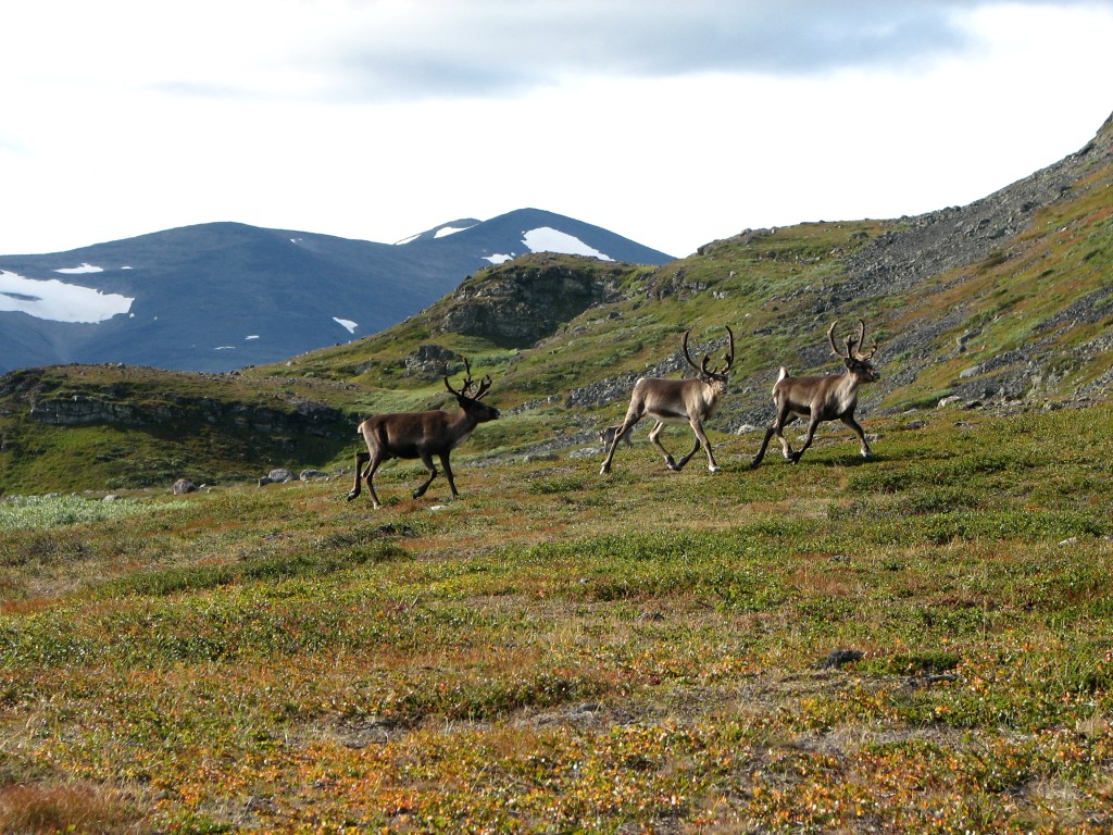
I made contact with a herd of reindeer, and after doing their usual circling motions they did their usual staring as I passed, heading for the next brook. This brook was, however, not really a brook at this height, owing to the lateness of the season, and I had to go down a few hundred meters before I found actual running water. The ground was rather bumpy and stony in the area, but I found a nice patch of heath with fully adequate views; things had actually improved somewhat from the descent, since there was a low rise nearby which reduced visibility higher up.
The west opening up again...
...like Visttasvággi
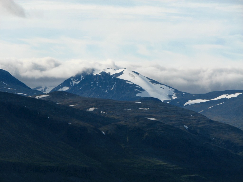
Niibbáš with its appealing glacier
Cloud-piercing Giebmegáisi
Govggečorru and the start of Gaippugorsa
The eastern mouth of Gaskkasvággi
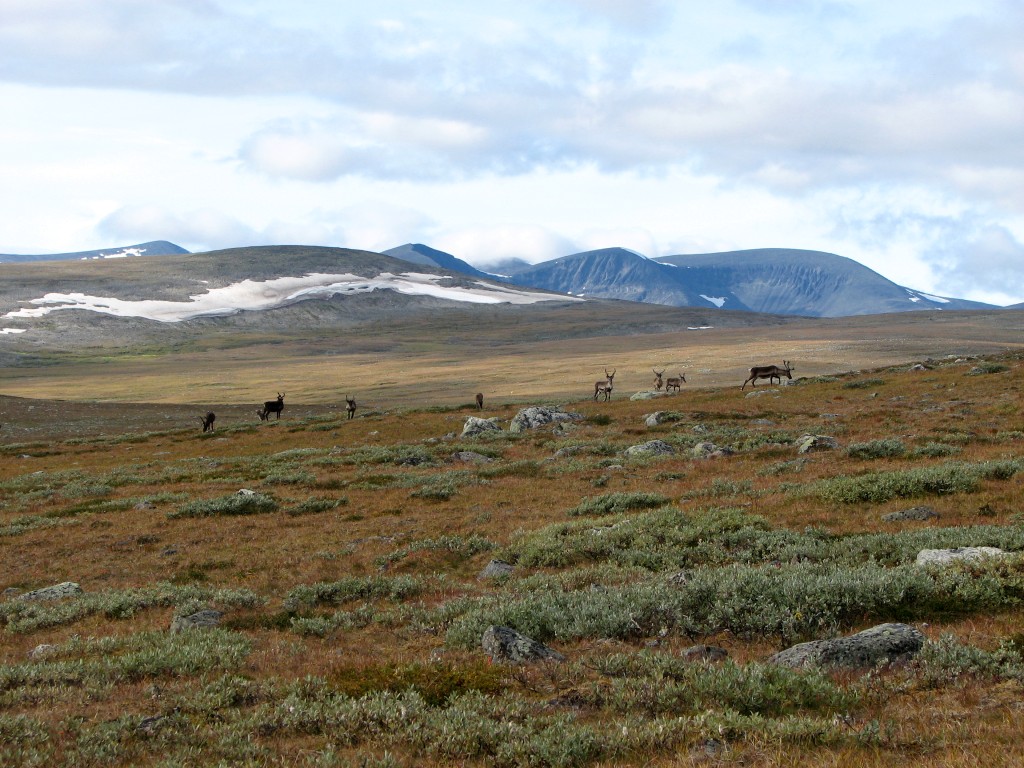
Even more reindeer!
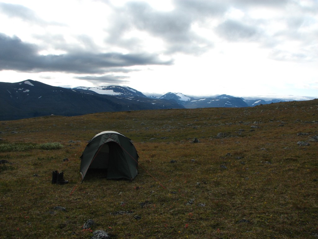
Stopped around here
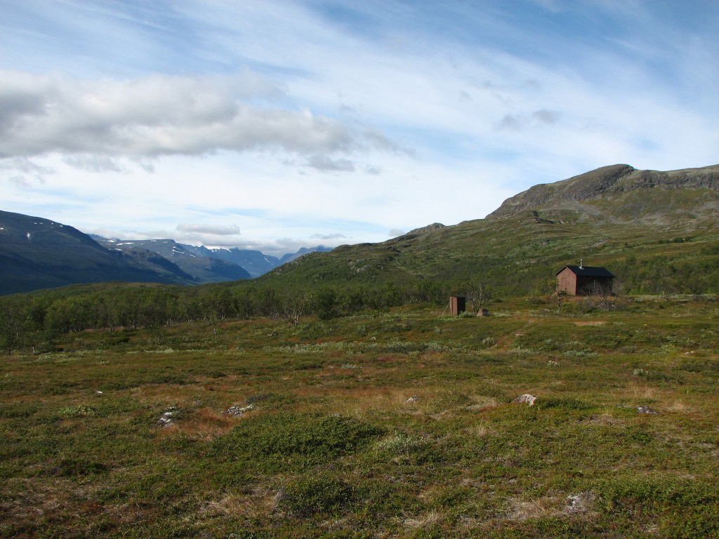
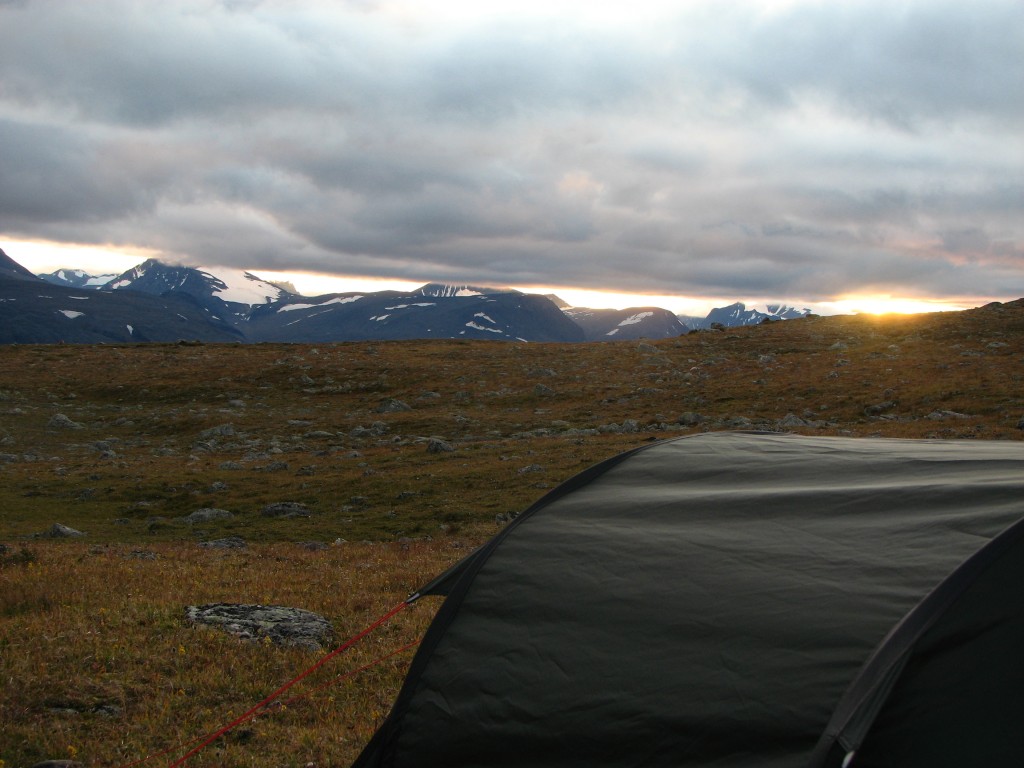
The time was now 16:30, and I set about pitching the tent straight away. At times I experienced a bit of weak sunlight, but in general the clouds were covering the sky; however, the clouds around the peaks across the valley were slowly rising. I then sat down for dinner in the open air, and I remained seated for a good while afterwards, just looking out over the landscape, savoring the feeling of being "at it" again. When the evening chill started setting in I entered the tent to relax and study the map.
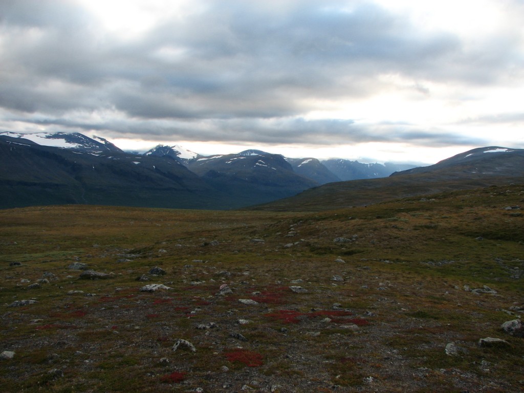
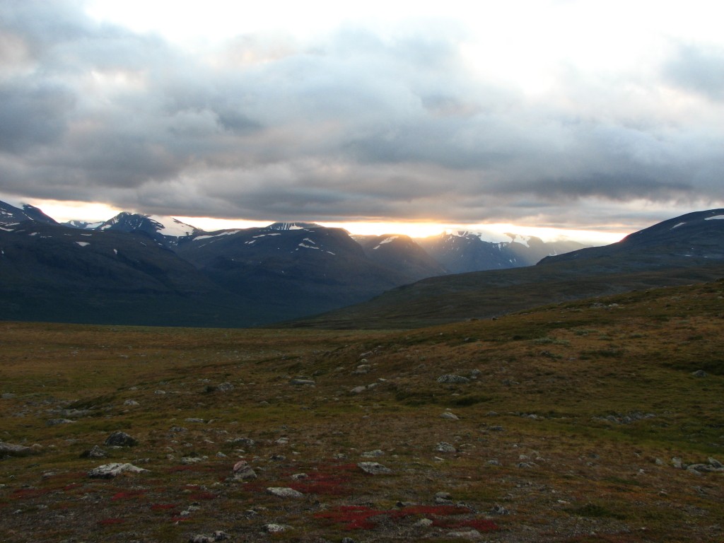
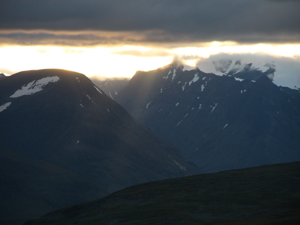
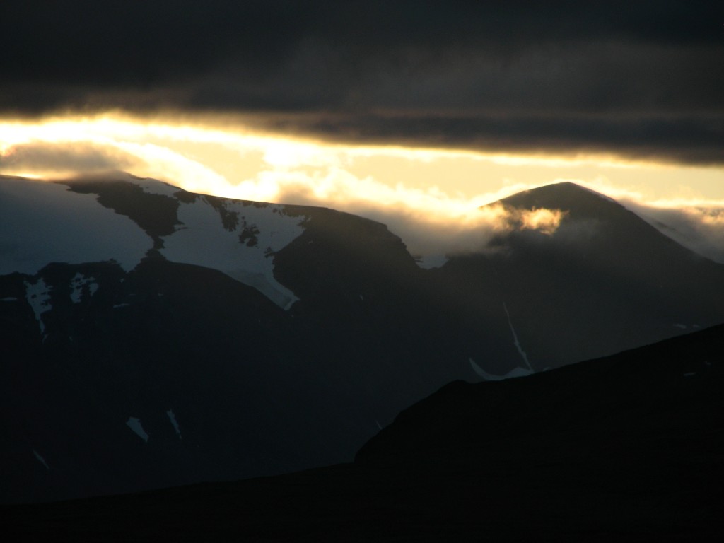
A bit later I went out for a walk down to a marked rock which did nicely as a lookout point; from there more of the valley was visible, but over it was an unbroken blanket of cloud. Over my own position, however, was quite a bit of blue sky, like off to the east and southeast, and far to the southwest there were no clouds at all. Back inside the tent I took to crosswords and sudoku, and upon looking out I saw a beautiful light as the sun set beneath the cloud cover, so I rushed back to the rock to observe and photograph. When the light had faded I crawled into the sleeping bag and started reading in my book, while the clouds pulled shut all around. I rested a bit before having my evening snack, and then I turned in after 21:45 in a near-total absence of wind.
All set
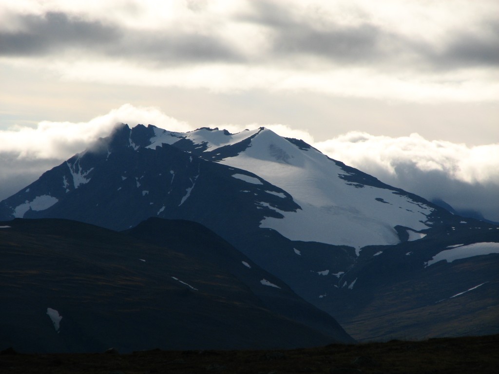
Closeup of Niibbáš
Fine evening sight
Finer evening sight
Kugghjulskammen
(Cogwheel Ridge)
Bossosčohkka
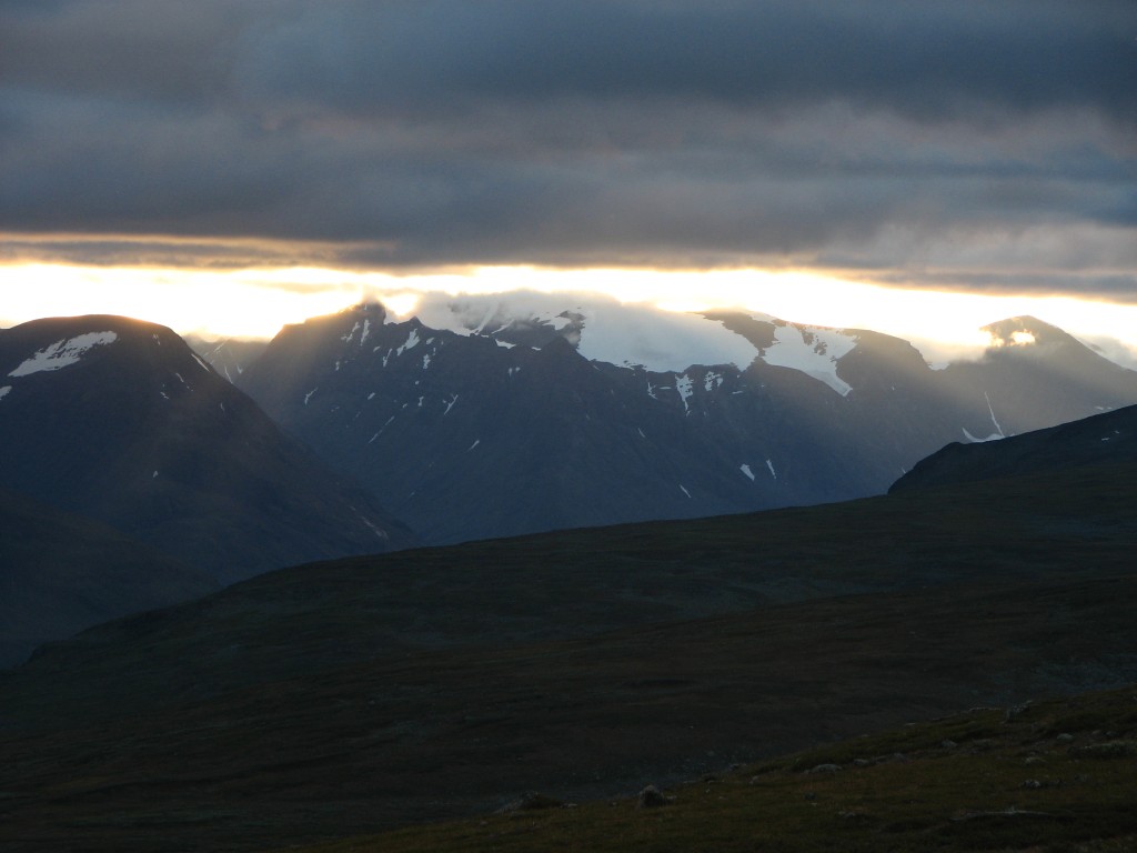
Wider view of the two
Back at the tent